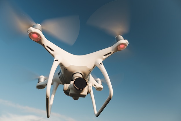
Drone footage grabs attention that ground-level cameras simply cannot. A single sweeping aerial shot can show an entire property, a packed event, or a construction site in seconds, giving viewers context that regular video misses. According to a 2025 report by the Federal Aviation Administration, registered commercial drones in the United States surpassed 427,000 units, reflecting how fast industries have adopted aerial imaging (FAA, 2025). At PixaQuant, we use professional drone shooting to help real estate agents, event organizers, builders, and brands tell a bigger story from above.
Why Does Aerial Footage Outperform Ground-Level Video?
Aerial footage outperforms because it reveals scale, layout, and location in a single frame. Ground video limits the viewer to one angle at a time, while a drone glides over, around, and above the subject, creating a sense of space that static shots cannot match.
Buyers and audiences process visual context fast. A drone clip of a property can show the house, the yard, the neighborhood, and nearby landmarks in under ten seconds. That immediate understanding keeps people watching longer, which improves recall and click-through rates.
Research from Wyzowl’s 2025 State of Video Marketing report found that 89% of consumers want to see more video from brands, and 83% say video has directly convinced them to buy a product or service (Wyzowl, 2025). Aerial shots stand out in feeds crowded with standard footage, giving your content a measurable edge.
How Does Drone Photography Help Real Estate Listings?
Drone photography helps real estate listings by showing the full property, lot boundaries, and surrounding neighborhood in one image set. Buyers immediately understand what they are getting, which speeds up decisions and reduces wasted viewings.
Aerial shots highlight features that ground photos miss. A large backyard, a private driveway, proximity to parks, or water frontage all become obvious from above. Listing agents who add drone imagery consistently report more inquiries and shorter time-on-market.
Multiple Listing Service data analyzed by Zillow research partners has shown that homes with aerial photos sell faster, often above list price, than similar homes without them. For agents competing in a crowded market, drone content is now a baseline expectation, not a luxury.
We have photographed luxury villas where the aerial reveal of the pool and coastline became the listing’s lead image. Those properties consistently drew more booked viewings within the first week online.
What Real Estate Drone Packages Usually Include
| Deliverable | Typical Use |
|---|---|
| High-res aerial photos | Listing galleries, print brochures |
| 4K cinematic video | Social reels, website hero sections |
| Twilight aerial shots | Premium listings, magazine features |
| Neighborhood context clips | Showing schools, parks, transit nearby |
Can Drone Videography Capture Live Events Effectively?
Yes, drone videography captures live events by recording crowd energy, venue scale, and outdoor action that handheld cameras cannot reach. A flyover shot of a festival, sports match, or corporate gathering adds production value instantly.
Event organizers use aerial clips for highlight reels, sponsor recaps, and promotional teasers for the following year. The same flight can produce both wide establishing shots and smooth tracking sequences of key moments.
We have found that scheduling the main drone flight during golden hour, the hour after sunrise or before sunset, produces richer colors and softer shadows. This single decision often improves the final edit more than any post-production filter.
Safety matters at events. Our pilots coordinate with venue staff, follow local altitude limits, and avoid flying directly over crowds unless regulations allow it. That planning keeps the footage both legal and usable.
How Do Construction Teams Use Aerial Progress Tracking?
Construction teams use aerial progress tracking by scheduling regular drone flights to document site changes week by week. The resulting photos and videos create an objective visual record that stakeholders can review from anywhere.
Builders share these updates with investors, architects, and clients without anyone needing to visit the site. Comparing this month’s image to last month’s makes progress obvious and helps catch issues early.
Beyond documentation, aerial data feeds into quantity surveys, earthwork calculations, and safety inspections. What once required a helicopter or a full survey crew now happens with a drone in under an hour, cutting costs significantly.
Across projects we have documented, a monthly drone flight typically replaced two to three site visits per stakeholder, saving roughly 60% of reporting time compared to manual photo logs.
Construction Drone Deliverables
Monthly orthomosaic maps, 3D site models, and side-by-side progress composites give project managers a clear picture of how work is advancing. Each deliverable serves a different audience, from accountants to site supervisors.
What Makes Drone Footage Strong for Brand Content?
Drone footage is strong for brand content because it creates cinematic visuals that feel premium without a film-crew budget. A smooth aerial shot of a product launch, a flagship store, or an outdoor campaign instantly raises production value.
Brands reuse aerial clips across commercials, social ads, and website backgrounds. One shoot can produce weeks of content when planned well, which keeps marketing costs predictable.
The goal is always emotional impact. A drone sweeping over a coastline, a city skyline, or a packed event gives viewers a sense of scale and excitement that static images struggle to deliver.
What Should You Expect From a Professional Drone Shoot?
A professional drone shoot includes planning, flying, and post-production. The process starts with a site survey, weather check, and flight plan, then moves to capturing footage, and finishes with color grading and editing.
Every PixaQuant pilot holds FAA Part 107 certification, carries liability insurance, and follows all no-fly-zone rules. That means your footage is not only high quality but also legally compliant, which protects you from fines and takedown requests.
Turnaround typically ranges from 48 hours for a basic edit to two weeks for a full cinematic package. We deliver files in formats ready for web, broadcast, and print, so your team can use them anywhere without re-exporting.
Frequently Asked Questions
How much does professional drone photography cost?
Pricing depends on location, flight time, and deliverables. Basic real estate packages often start around a few hundred dollars, while full-day cinematic shoots cost more. Most projects pay for themselves through faster sales or stronger campaign performance.
Do I need permission to fly a drone over my property?
In most countries, commercial drone flights require a licensed pilot. In the U.S., that means a Part 107 certificate. PixaQuant handles permits and airspace approvals, so you do not have to deal with paperwork.
Can drones fly indoors?
Yes, specialized indoor drones can capture footage inside warehouses, factories, and large venues. These flights require smaller aircraft and careful planning to avoid obstacles and people.
What weather conditions stop a drone shoot?
Heavy rain, snow, fog, and winds above 20 mph usually ground our flights. We monitor forecasts closely and reschedule at no extra cost when conditions would compromise safety or image quality.
Conclusion
Professional drone shooting turns ordinary listings, events, and campaigns into memorable visual stories. From real estate showcases that sell faster to construction updates that save site visits, aerial footage delivers measurable value across industries. With licensed pilots, modern equipment, and a clear editing workflow, PixaQuant helps you capture footage that stands out in crowded feeds and serious presentations alike. If you are ready to see your project from a new angle, our drone team is ready to plan the first flight.